Delphi Murders - Crime Scene Access
Some people theorize the victims of the Delphi murders got a ride away from the bridge before they were murdered, and their bodies were moved and placed across the creek, on the north side, in the middle of the night. The landowner, the late Ronald Logan, told WTHR in 2017 "You couldn't carry someone up and down these hills. It's hard to walk by yourself," in a report that showed him and the news crew walking the hills. The Deer Creek valley near the Monon High Bridge is surrounded by steep hills, but the Logan property is an exception.
On the south side of the creek, there is a county road, gated overnight, and marked private, which leads from under the south(east) end of the bridge south into Delphi. It provided access to the creek during the search for the girls and might be the ambulance route if anyone ever falls off the bridge. But crossing the creek from south to north is not easy due to a steep bank on the north side.
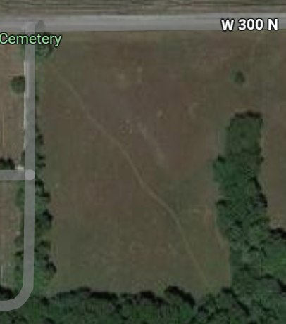
The private land on the north side of the creek is now owned by a member of Logan's family. A check of a USGS topological map reveals two speculative paths for a vehicle to get from the road to the final crime scene, and out again. Only someone familiar with the property was likely to know about either. Hunters and other locals may know about one as evidenced by what may be a footpath from just east of the eastern cemetery entrance off 300 North, through a field to the woods, which shows up as a line across the soil on Google maps.

A topological map has contour lines drawn for every ten feet of change in elevation. When the lines are close together, that's steep. When they are far apart, that's less steep. If you know the distance between the lines, you can calculate the general slope.
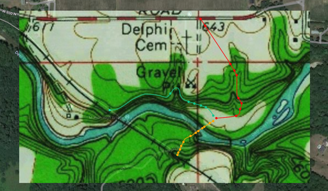
Combining a Google view and a topological map, I traced out the flattest route I could guess, from the cemetery to the crime scene. The result is shown in the video.
The video is a quick slideshow and is designed to show how the path, contour lines and landscape match up, fading from one to the other. Play it and pause it at points of interest. The red dots mark where the path crosses a contour line, and assumes the steepest declines could be negotiated by driving on a diagonal path, not straight down the slope.
The other speculative path is just to the east, with no need to cross a small ravine and good distance between some of the contour lines. You can stop the video on the topological map and see where it could be.
The steepest portion of the path happens to be around the thicker black 50-foot interval line on the topo map, marking an 8.8 degree slope over 64 feet. (By the way, for comparison, a wheelchair ramp's maximum allowable incline is 4.8 degrees.)
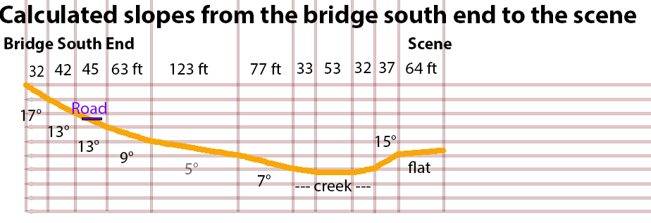
The chart below shows the slopes along the path, overlooking any contour variations between the lines. And of course we don't know about fences and tree trunks, although, in general, videos others have made show the forest is not thick, and there is often enough space to manuever between trees while running over smaller plants and fallen branches.

Driving to the scene would be unwise, reckless and dangerous, but it might not be impossible. Please don't try it.
Here's a link to a video segment in which a drone pans over the Logan property before it heads downstream toward the bridge.
Other Paths

From the Monon High Bridge trail
The blue line traces a possible walking path from the north(west) end of the bridge to the crime scene. There is a ravine to cross and it is not drivable. As with all the paths, most of it is on private property. The line skirts a direct path through the ravine, and goes diagonally down the final slopes to minimize them.

"Guys . . . down the hill"
The yellow path starts where bridge guy first spoke to the girls and they started down the hill. We don't know the route after that. This one goes directly to the final crime scene. It has steep slopes. The line goes down to the surface of the creek, then up again. The road from under the bridge leads up to a private residence and does not show up on the topological map, but is noted in the chart.

These are idealized contours with the actual terrain represented by straight lines, so all these charts can do is give a rough idea.